Great Jupiter! While Marty McFly was speeding around in his DeLorean in the first “Back to the Future,” in 1985 a group of Silicon Valley visionaries were about to send the very concept of street navigation into the past. Their name? Etak. What was their invention called? Navigator, the world's first satellite navigator, well before GPS became the standard.
“Where we go we don't need roads”, but a navigator is always useful, right?
A compass for the digital age
A jewel of technology and ingenuity, capable of tracing the route on digital maps using sensors, algorithms and a pinch of magic. A story of pioneers, impossible challenges and twists worthy of a film. Because sometimes, to move forward, you must first take a step back.
Imagine traveling in that magical year. Everything was different: me, for example. I was 10 years old while Reagan and Gorbachev were negotiating the end of the Cold War, Duran Duran was all the rage on the radio, and we still relied on old dear paper maps to orient ourselves on the roads. Inconvenient, cumbersome, often difficult to decipher. Tragicomics. The idea of an electronic navigator, something that would tell you where to go? Science fiction, Star Wars stuff.
Yet, in the futuristic Silicon Valley there were those who were already working to turn that dream into reality. Etak, a handful of visionary engineers led by Stan Honey, world-renowned navigator with a passion for innovation.
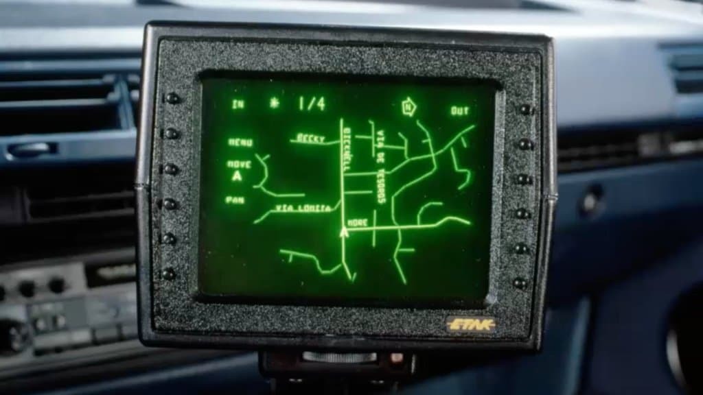
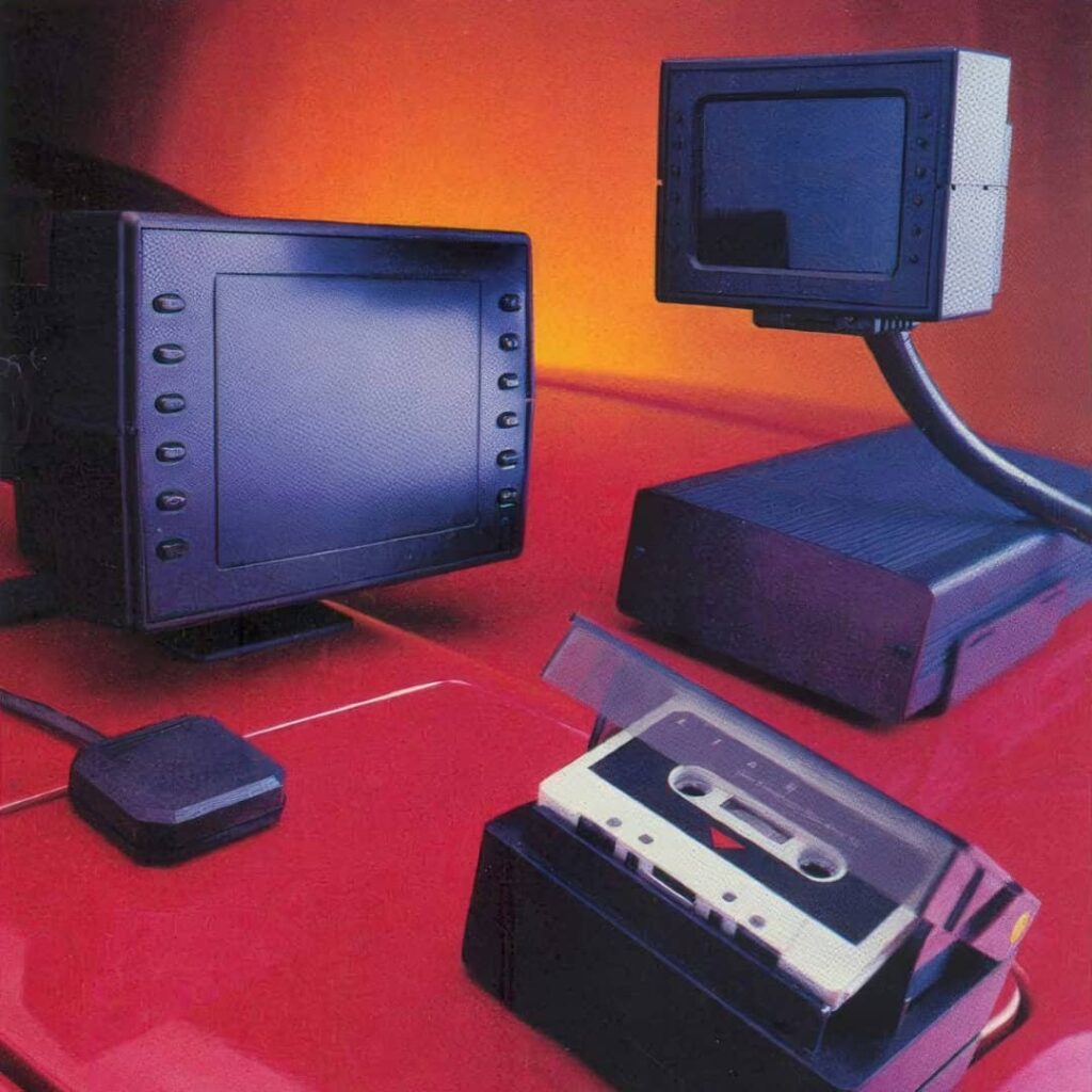
Navigator is something that the world he's never seen before. Think of a magic box to be mounted on the dashboard of the car. Inside there is a cathode ray tube vector screen, like those of the first video games. Instead of Space Invaders, it shows you the way forward, complete with scrolling maps, points of interest and step-by-step instructions. A compass for the digital age.
Guessing, but with style
In 1985 Napoli had not yet won their first scudetto, and the GPS was still a mirage, reserved for a select few with stars. So how does the Etak Navigator know where you are and where you are going? Simple: it keeps you guessing, but with style. Using a technique derived from nautical and called 'dead reckoning' (dead reckoning), which is based on motion sensors and a compass, in this case electronic.
In practice, the Navigator records your every curve and acceleration, and compares this data with the digital maps stored on board. So, by exclusion, it understands which street you are on and updates your position in real time. A bit like a human navigator does when he says: “We should be about here, since we turned there”.
It seems like magic, wish it were: it would be easier. It's pure engineering, and to make the dead reckoning work reliably Stan Honey and co have to invent everything: from a compass (compensated, to cancel the magnetic field of the heated rear window) to a liquid inclinometer (filled with tequila, the bad guys will say).
Roads are really useful
Etak's real challenge, the toughest of all, was another: that of creating digital maps. Today we are used to Google Maps and OpenStreetMap, with their global databases just a click away. But in 1985 maps were just pieces of paper. How to transform them into navigable bits and bytes?
Etak's response was what you would expect: with lots and lots of patience. Scanning the maps one by one. You remember the scanners from 1985, yes? The beautiful ones, drum-shaped. And then, to paraphrase Baglioni, "a dizziness of digitalisation". Every street, every intersection, every point of interest. With teams of digital cartographers working around the clock on cathode ray tube terminals. The world's first high-scale digital map production system.
Not only that: to store all that information in a few precious megabytes, Etak engineers invented truly ultra-efficient data compression algorithms, which exploited the topological structure of roads. In essence, they did for maps what MP3 would do for music twenty years later. Stuff that would make modern data scientists pale.
A navigator born to navigate
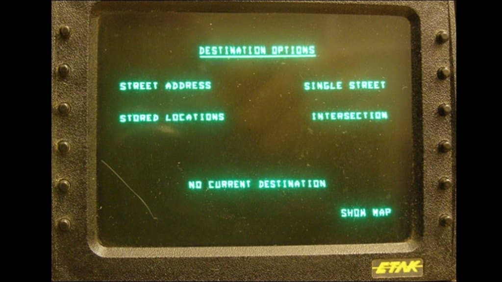
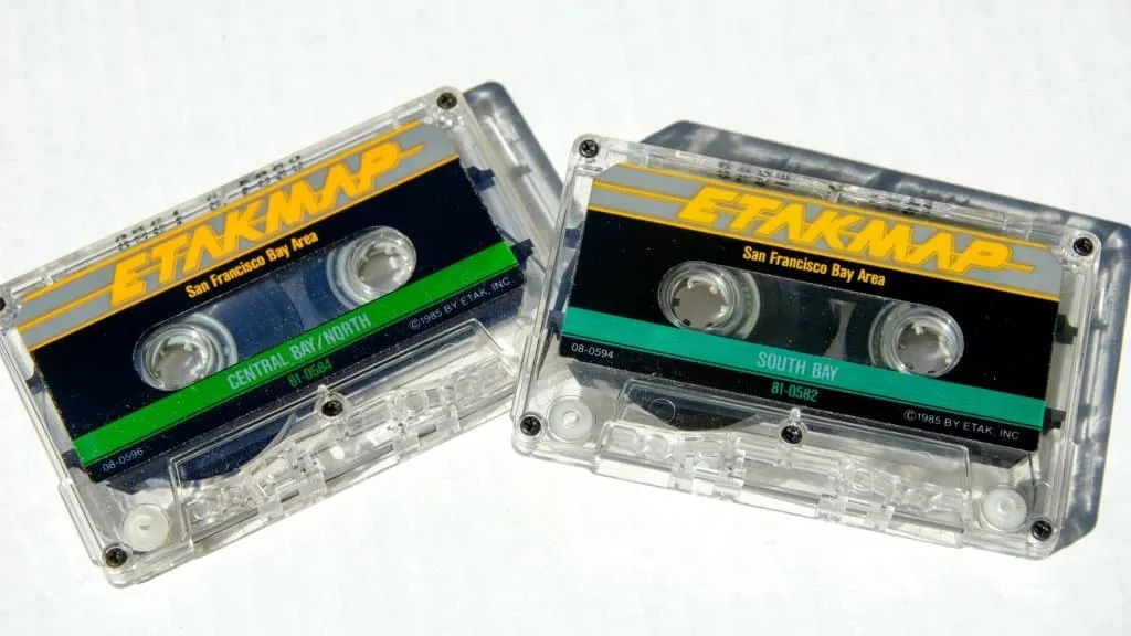
The result of this titanic effort? A product that seemed to come straight from the future. The Etak Navigator impressed everyone with its almost magical capabilities. Find an address? It was enough to insert it with a few clicks. See your location on a map? Done. Follow a course towards the goal? He took care of it, very nice, complete with zoom and very smooth scrolling. Of course, there were limits. The maps covered only a few metropolitan areas, and to get them all you needed six expensive cassettes. Installing the system required hours and a skilled technician. And then the price, a factor that always has an impact (just think that today it also brings Apple's ambitions to its knees, not exactly the latest arrival).
It wasn't popular: 1.395 dollars, practically 4.000 euros today. And in fact it was stuff for VIPs, who couldn't do without it: among the first buyers were people like Spielberg and Michael Jackson. Yes sir, the Etak Navigator was the navigator of the stars, the ultimate for those who wanted to stand out. And never mind if it sometimes drove you off track: the important thing was to get there in style.
The giant who came from the sea
The real turning point for Etak came from a buyer as unexpected as it was visionary: Rupert Murdoch, the Australian media mogul. Yes: “The Young Murdoch” (so to speak, he was already 56 years old). He was his technological right-hand man, John evans, to smell the potential of that magic box and its digital maps. So in 1987 Murdoch bought all of Etak to use its know-how in a secret project called “Jaguar”.
The idea? Combine Etak navigator maps with a database of hotels, restaurants and attractions, and create an interactive travel guide complete with photos and virtual tours. A crazy idea for the time, which predated Trip Advisor and Google Street View by twenty years. And guess what?
Jaguar never took off, and in 1989 Murdoch raised the white flag. Of course, he resold the system to a British media company and still pocketed a capital gain of $500 million. Even losing, like getting lost, is a question of style.
It was the beginning of the end for Etak, which passed from hand to hand like the bomb from the Hanna & Barbera cartoons: from Sony a Tele Atlas until arriving (ironically) at TomTom, the Dutch navigation giant. In the meantime, however, the advent of GPS had made the dead reckoning technology obsolete, sending the Etak navigator and his heirs into the attic. Go, Navigator, teach the angels to roll down the window and ask the first passerby the way to Paradise.
The navigator that inspired a generation
Etak's navigator legacy goes beyond the technical aspects. He lies in having demonstrated that it is possible to innovate even in an apparently immutable field: for how many centuries have we oriented ourselves "the old way"? These people dared the impossible, challenging the standards and prejudices of the time (I repeat, they did it without GPS satellites). He created from nothing an industry that is now worth billions and which has changed the way we move and explore the world.
It is no coincidence that many of Etak's protagonists have become industry legends. Catwalk for you guys, like in concerts: Stan Honey, pioneer of GPS and genius of sports navigation; John evans, visionary of geolocation and augmented reality; Marv White, digital map wizard and inspiration for generations of hi-tech cartographers. And many others who brought the spirit of Etak to companies like Apple, Google, Tesla, changing the face of technology forever.
Etak navigator, are you still among us?
The spirit of Etak still lingers among us. Do you hear it? It is also here, now, as I write to you. Don't you believe it? Look at your navigator, or your maps app (Google Maps, Waze and co.). You'll see it there: the symbol used in your navigators to represent the car's location. A stylized arrow, essential and elegant, always pointing forward. The exact same.
It's not just a tribute to the pioneer of digital navigation. It is a symbol of his indomitable spirit, of his ability to point the way even when the goal seems unattainable. To transform the unknown into the explored, the impossible into the obvious, the future into the present. Just like the Etak Navigator did, way back in 1985 which today appears to us as too foreign a country, and even the Cold War seems better.
For this reason, if the satellite navigator leads you astray, don't worry too much. After all, even if you make mistakes you get somewhere. The important thing is to continue following that arrow, that spark of the future that guides us towards the unknown. Always forward, towards new goals and new discoveries. Just like Marty McFly would have done.