
Fridtjof Nansen, the leader of the first expedition to cross Greenland, once described what he found in the Arctic as “the great adventure of ice, deep and pure as infinity.” Nansen, who made his trip in 1888, could not have known the wonders hidden beneath the frozen landscape beneath his skis.
Today, thanks to radar and other technologies, the part of Greenland that lies beneath its 3000-meter (9.800-foot) ice sheet is coming into focus. These new tools reveal a complex, invisible landscape that holds clues to the Arctic's past and future. Here are 6 elements that have emerged over the years from various research.
The longest canyon in the world.
Discovered in 2013, this canyon stretches for 740 kilometers (460 miles) from the highest point in central Greenland to the Petermann Glacier on the northwest coast. It is significantly longer than the longest canyon in the world, the Yarlung Tsangpo Grand Canyon (496 km) in China.
The canyon plunges to 800 meters (2.600 feet) deep in places and is 10 kilometers (6 miles) wide. For comparison, the Grand Canyon in Arizona averages around 1,6km (1 mile) in depth and 16km (10 miles) in diameter.
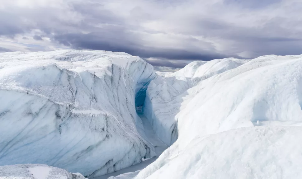
Parts of this canyon may channel meltwater to the sea: it probably formed before the ice sheet and was once the channel of a giant river.
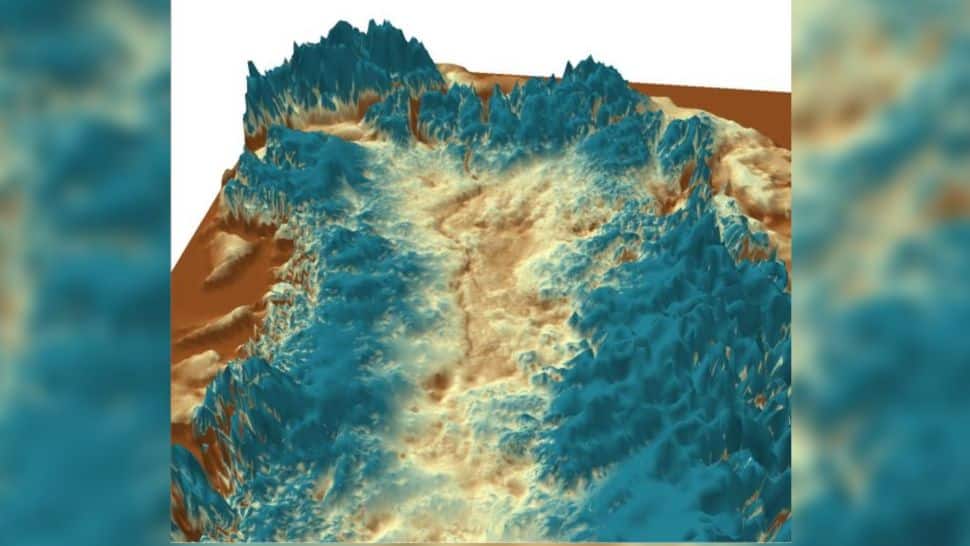
Invisible mountains.
The canyon isn't the only rugged part of the landscape hiding beneath Greenland's ice. Decades of mapping the island using ice-penetrating radar (which is usually mounted on airplanes) has revealed mountain ranges and fjords beneath the ice sheet.
A map of 2017 of Greenland stripped of its ice shows a bowl-shaped depression in the center of the island. A circle of coastal mountain ranges surrounds this depression. The map revealed the topography at the base of Greenland's flowing glaciers, which can help scientists predict how fast glaciers will move under warming conditions and how quickly they will unleash icebergs into the ocean.
A primeval lake.

Hundreds of thousands or millions of years ago, before Greenland was covered in ice, it was home to a gigantic lake, reaching 250 meters deep in some places. Its basin covers 7100 square kilometers (2700 miles), and was fed by at least 18 different waterways.
The lakebed may hold valuable clues to the Arctic climate in the distant past. Uncovering these secrets, however, would require drilling through the 1,8 kilometers (1,1 miles) of ice that now covers the ancient site.
The Greenland ice sheet also hides a landscape of jewel-like lakes filled with crystalline melt water. There are at least 60 of these small lakes, mostly clustered in northern and eastern Greenland.
The lakes range in size from 200 meters (656 feet) to 5,9 kilometers (3,7 miles) in diameter. Meltwater in these lakes may flow from the surface of the ice sheet, or it may melt from friction from the movement of ice or geothermal energy from below.
Meteorite impact craters

Not all of the topography under the ice sheet is of terrestrial origin. Scientists have found at least two probable meteorite craters buried under the ice. Both are located in northwestern Greenland: one is located under the glacier Hiawatha, the other is about 183 kilometers (114 miles) from the first. This second crater is the 22nd largest impact crater ever found on Earth.
Perfectly preserved fossil plants

An ice core excavated during a Cold War-era attempt to build a nuclear weapons base has revealed perfectly preserved fossils of plants dating back a million years.
“The best word to describe them is FREEZE-DRIED,” he says Andrew Christ, lead author of a core study and professor in the Department of Geology at the University of Vermont in Burlington. “When we took them out and put some water in them, they sort of reopened, they looked like they died yesterday.”
The core came from northwestern Greenland, and the plants contained within may have grown in a boreal forest. Such a forest could only grow in largely ice-free conditions, suggesting that parts of Greenland's ice sheet may be much younger than researchers previously believed.

